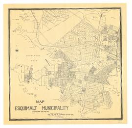
- CA PR012-990-017-001
- Unidad documental simple
- 1913
Parte deJames Findlay fonds
5 resultados con objetos digitales Muestra los resultados con objetos digitales
Parte deJames Findlay fonds
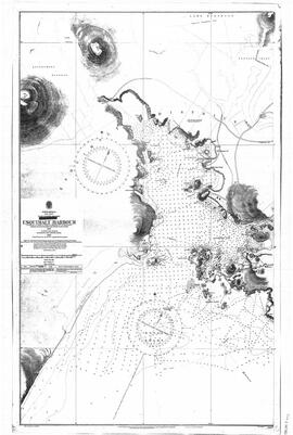
Admiralty Chart of Esquimalt Harbour
Parte deJames Findlay fonds
The collection consists of single or small accumulations of photographs, textual records, maps, and other material donated to the Esquimalt Municipal Archives by unknown private individuals, businesses, and organizations over many years.
Sin título
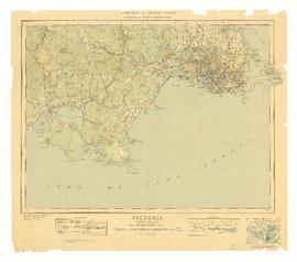
Military topographical map of "Victoria"
Parte deJames Findlay fonds
Topographical map of Victoria, covering area from Discovery Island to Race Rocks.
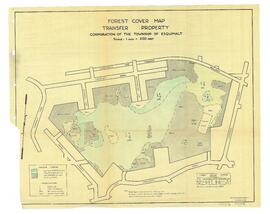
Forest Cover Map, Transfer Property
Parte deTownship of Esquimalt fonds
Forest Cover Map of the Transfer Property within the Township of Esquimalt.
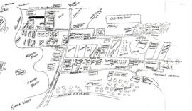
Hand-drawn map of Old Esquimalt Village in the 1930s by Ken Bendall
Parte deKenneth Bendall fonds
The fonds consists of photographs of Old Esquimalt Village, the Point Ellice Bridge disaster, and staff and buildings of Esquimalt businesses. Fonds includes a photocopied map relating to the expropriation of Esquimalt Village during World War II.
Sin título
The fonds consists of photographs of buildings on Cole Island in Esquimalt Harbour, and a map showing their locations.
Sin título
City of Victoria Archives collection
Collection consists of bound and unbound maps of Victoria and Esquimalt, a Victoria directory from 1860, a document showing polling divisions in Esquimalt (1925), and photographs of Wolfenden family members and B. C. Land and Investment Agency.
Sin título
Esquimalt fire insurance maps collection
Collection consists of Fire Insurance maps of Victoria and Esquimalt that show details such as building construction, alarms, heating, hydrants and fire mains.