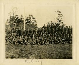
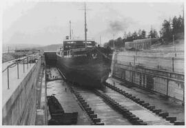
CFB Esquimalt

Elements area

Taxonomy

Code

Scope note(s)

  • Includes records relating to regions that were or became jurisdiction of the Government of Canada, and are now collectively referred to as CFB Esquimalt.

Source note(s)

    Display note(s)

      Equivalent terms

      CFB Esquimalt

        Associated terms

        CFB Esquimalt

          276 Archival description results for CFB Esquimalt

          Roy Smith fonds
          CA PR386 · Fonds · [ca. 1917], 1943

          Fonds consists of a copy of a subdivision plan (Block VI and part of Block VIII) of Viewfield (1943), and three photographs of individuals at Work Point Barracks.

          Smith, Roy
          CA PR032-v990-032-002 · Item · ca. 1929
          Part of Ida Banfield fonds

          Photo of a ship in drydock as seen from 611 Pioneer St. (Old Esquimalt Village). Soue Kee laundry and Burnett Foundry can be seen on left. Large house (left) belonged to Harry Smith.

          Residential area in Dockyard
          CA PR280-995-024-008 · Item · 1910
          Part of Edward Young fonds

          Photo of residential area and Mesher Beach from across the bay. Boat launch on left. Pumphouse chimney at Old Drydock visible in background. Esquimalt Road or Hospital Road trestle at base of Signal Hill on extreme right.