Identity area
Reference code
CA PR012-994-047-001
Title
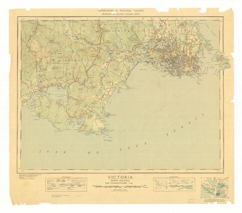
Military topographical map of "Victoria"
Date(s)
- 1945 (Creation)
Level of description
Item
Extent and medium
1 map.
Context area
Name of creator
(1927-)
Repository
Archival history
Donated to Esquimalt Municipal Archives, Accession 994-047.
Immediate source of acquisition or transfer
Content and structure area
Scope and content
Topographical map of Victoria, covering area from Discovery Island to Race Rocks.
Appraisal, destruction and scheduling
Accruals
System of arrangement
Conditions of access and use area
Conditions governing access
There are no restrictions on access to these records.
Conditions governing reproduction
Researchers are responsible for observing Canadian copyright regulations.
Language of material
English
Script of material
Language and script notes
Physical characteristics and technical requirements
Finding aids
Allied materials area
Existence and location of originals
Existence and location of copies
Related units of description
Notes area
Note
Published by the Department of National Defence' Geographical Section, using information from 1933 aerial photographs taken by R.C.A.F.